
 Type: Mountain Biking & Hiking Trail
Location: Phoenix Mountain Preserve
Difficulty: Moderate Terrain
Distance: 8 – Infinite Miles
Hiking Rating: Fair at best
Biking Rating: Good
Last Biked On: June 1, 2013
Map: Google Map : City of Phoenix PDF Map : Green Trails Map
Overview
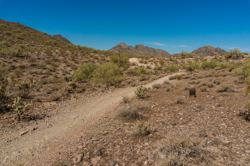
Trail 100 is 10 miles of uninterrupted trail with lots spurs. The East section (between Dreamy Draw and Tatum Blvd) is four miles with a two main parking lot access points. The majority of the trail sits in a bowl nestled between several peaks. This bowl is criss-crossed with what seem like an infinite number of side trails. This, combined with what can best be described as anemic signage, makes going off course fairly easy. The signage is quite poor right around the Dreamy Draw trail head, but once you are on the trail and over the first peak, the signage gets much better. And though Phoenix Mountain Preserve is a sprawling park with miles of uninterrupted trails, it is very much in Phoenix. As such, you are never that far from civilization, but it is still especially important to bring more water than you think you will need.
In addition to the lack luster signage, the route chosen for Trail 100 seems a bit weird too, especially from the underpass that goes under 51 to the saddle where it hooks up to “The Berry” climb. It’s much more direct to head up “The Berry”. To do this, start up the ramp at the East corner of the Dreamy Draw parking lot and follow it past the toilets and then take a right onto the main paved path, about 300 feet down the path on the left is where the trail starts.
The terrain is the typical Phoenix mix of smooth rolling trails and treacherous ankle snapping (and wheel tacoing) rocky madness.
Trail 100 is the easiest and most moderate way to get from Dreamy Draw to Tatum and it would be a good bet for a beginner who has mastered Papago, but there are a lot of great trails criss crossing the park, so go find them!
Facilities
There a large parking lots with water and restrooms at both Dreamy Draw and 40th Street. Though these are fairly large parking areas, they are easily overwhelmed in season and especially in the early morning as depicted in the images below.
Dreamy Draw has parking for horse trailers, a couple of modest ramadas, and a little open space where yoga classes are occasionally held.
There is a third parking lot on Tatum Blvd that marks the far East end of Trail 100. But with only five (+1 handicap) spaces it is laughably small and almost always full. The only chance of getting a spot there would be to call ahead for reservations…
Mountain Biking
What can I say, I like riding here. It’s not crazy technical like National/Mormon or long like Desert Classic, but it feels more like roaming. And, because it is smaller, it is easier to digest. It certainly has its challenges – if you are starting from Dreamy Draw one of the first things you will encounter is “The Berry” climb (I don’t know who coined this name, or if anyone outside of Strava will recognize it). It doesn’t seem that steep or long at the beginning, but you will soon know how in shape you are as you climb it.
Once you have conquered The Berry, you can head East to follow Trail 100, but I head North until I hit the edge of the park and then skirt the North edge of the park. This isn’t necessarily the best trail, maybe it is just the voyeuristic pleasure of looking over into people’s back yards as I ride by. Running into the parking lot at 40th Street, I then head South on a fire road, which is possibly the most boring trail in Phoenix. It is straight with a mild but unyielding ascent and is typically packed with hikers. At the first chance, I veer off to the left (East) to meet up with Trail 100 again and follow that out to the end.
Once I’ve had a good laugh at the minuscule parking lot on Tatum Blvd, I backtrack Trail 100 until I hit Trail 8 (just past the fire road), then follow as it turns South and then West. If you find yourself knee deep in rocks, you’ve gone too far and missed the turn off where 8 starts to head West. Not surprising given the poor signage. This will bring you around a couple of the smaller peaks heading South. There will be a sharp intersection where you can turn North and this will take you back to 100. Taking a sharp left (West) will put you on course back to Dreamy Draw. From here, it’s pretty straight forward to follow 100 back to The Berry and follow that down to Dream Draw.
Hiking
Trail 100 is a great uninterrupted trail, but for hiking, it is a bit tedious and not particularly scenic. Trails 1A, 8A, 302, 304, and Piewesta Summit are all far better trails and start on the other side of Piewesta Peak (1A is also accessible from Dreamy Draw). Additionally, Trail 100 sees a lot of mountain biker traffic.
For hiking, I skip Trail 100.
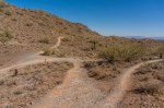
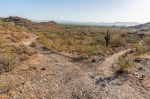
Pictures of Trail 100 – East at Phoenix Mountain Preserve
-

- Full lot


Google Map of Trail 100 – East
The orange line traces the official route of Trail 100. The purple line traces one route I usually take. And the red line shows where my route and Trail 100 overlap.
